The Latest From BostonBiker.org
News, Events, Updates
My Little Bike Ride
Written by Boston Biker on Aug 13You ever come up with ideas that run around in your head? The kind that don’t seem to leave? A while ago I got one, and it has been stewing for a bit. What would it be like to ride my bike out to Provincetown, what would it be like to do it all at once, and what would it be like to do it on a fixed gear? Yesterday I got up at 6am and strapped on my bike bag and road my bike out to P-town.
Before I tell you about the trip a bit of background. The longest ride I have ever taken on a bike was 70 miles. I didn’t train for this ride. I was actually kind of nervous, and didn’t sleep very well the night before. So before you go thinking I do this sort of thing all the time…I don’t. I am a strong cyclist, but no Lance Armstrong. The idea of this trip both excited me and scared me a bit.
I started north of Boston in fair Sumerville. Following roughly this route (with some additions and some backtracking).
I made good time through the city, I was familiar with the roads and didn’t have to check any maps. The city was just waking up. I was relaxed and not in any particular rush. The sky was overcast, and the air was cool. Absolutely perfect weather for biking. I had forgone any real cycling for the two days prior and my legs felt alive and strong under me, they were excited and I had to remind them that this was a long ride and that we couldn’t do our usual mad dash through town.
Handsome men and beautiful women ran through the street getting their morning exercise before the rest of us even wake up (if you ever meet one of these people and you wonder why they have such nice bodies…it’s cause they work at it harder than we do). The few people already on the road driving to work did so at a leisurely pace, when you are heading to work at 6am there is far less traffic to contend with.
I don’t know about you but I can’t go to JP without getting lost. I already have a very poor sense of direction and for some reason JP does it to me every time. After spending 10 minutes trying to find out how you get from Brookline to the Jamaica way (I have no idea why this is so hard…JP my direction nemesis!) I gave up, backtracked to a route I do know (South Huntington to Centre) and was on my way.
After saying goodbye to JP I went perhaps a little faster than I had planned and soon found myself flying down some lovely hills around Turtle pond. This was when I first started noticing little painted marks on the road. Seems some intrepid bikers had been down this route before and had left small almost hidden signs of the way to go. I came to be friends with these marks over the long journey, thanks teal triangle with line through it, and yellow arrow with two dots, and double P with an L in the middle, you kept me company and helped me find my way all the way to the end. When I was running out of juice in the last couple miles, every teal triangle with a line through it would squeeze just a little more go out of me…strange but true.
I made excellent time down 138 and around the bottom of the Blue Hills reservation. Which incidentally is when I first started to perhaps consider doing this on a road bike next time…did you know the Blue Hills are umm kind of hilly? I was feeling really good at this point and the constant climb (mash mash mash) and decline (pedal pedal pedal!) was really fun. I saw not a single other cyclist until I hit Cape Cod, and it felt strange to have these roads to myself (so to speak, cars were still there). The roads of the route (linked above) are smooth, and there are very few red lights or stop signs. You can go for a long time before anything interrupts your rhythm and it is glorious.
Riding long distance on a fixed gear gets you into a rhythm pretty quickly. Up down, up down, go go go, thump thump thump, after a while it becomes internalized and you just feel amazing, like you could go forever. The bottom half of your body disappears and it is like you are riding around on a magic carpet. Before I knew it I had gone through Randolph, Avon, Brockton, and East Bridgewater. Fine little towns, full of nice views and a smattering of CVS’s and other stores that can serve as water stations and candy pickups.
I only looked at my watch twice on this journey, once when I got to Cape Cod, and once when I got to Wellfleet, it helped produce a sense of timeless floating that I enjoyed a lot. After another while Robbins pond, and Robbins Reservoir (both very nice) floated by. Plympton and then Plymoth were next. This is when things started to get interesting (from a bike choice point of view) till this point there had been relatively few hills most of them were long climbs and long descents (except for a couple in the Blue Hills). Once you “make the turn” through the middle of Plymouth the hills start. Lots of them, some steep, some not so steep, but ohhh my you will be going up and down a lot. My strategy was to try and maintain a nice steady cadence going up and just BOMB down. This strategy was two fold, one it is really fun to go really FAST, and also the gained momentum lessened the grind going up the next one. Some place around Long Pond I had to walk up my first hill. Not because it was super steep (it was) but because there had been a series of simply brutal tiny hills and declines before it and well…I was just not having that last one. If you have never ridden a fixed gear this might not make sense to you (going down hill can be as energy intensive as going up), but trust me after like 20 hills you get a little pooped.
There are very few cars that travel the Clair Saltonstall Bikeway (which I was following), so I didn’t have to think much about them. In fact I only got harassed by one single car the whole way, and that was a couple of punk ass kids in the Mid cape area of all places. Overall people gave me lots of room and were so nice that I actually stopped thinking about cars after a while (a potentially dangerous move, but I was at mile 60-70 or something at this point and my brain was trying to deal with the fact that this was now the longest I had ever ridden any bike). I got into a routine. I had taken a road atlas and traced the route I was taking, then tore the pages out that were relevant to my trip. I put the wad of 25 or so pages in my bag and would take one out and put it in my crumpler cellphone chest strap, taking it out once in a while for a little no hand riding map reading. I would say to myself “when you get to Long Pond road take a right then change maps.” At each map change I would rehydrate, eat if I was hungry (or even sometimes if I wasn’t), stretch and then review the next map. This led to several stopping about ever 10 miles or so. A nice system that kept me well hydrated and well fed.
I used to live on Cape Cod, for four years I enjoyed it very much. Cape Cod is a strange and wonderful place, filled with some of the most beautiful places you have ever pointed your eyes at, and also home to some brutal poverty, and the most ironic wealth on the planet (Cape wind anyone…jebus I grew to loath the rich people who opposed that project). I loved living there, but this trip was not a sight seeing trip this was a journey of testing my physical limits, and having fun on a bike. The journey was the reason, The Cape served as a beautiful backdrop to have my adventure on.
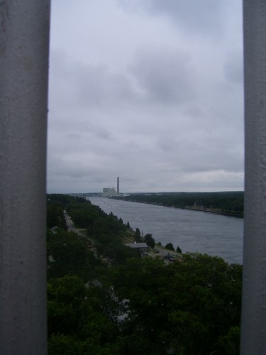
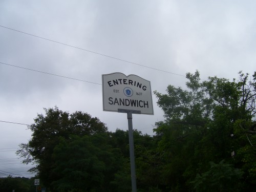
Since I last lived there the Sagamore flyover had been completed, it was no longer a simple matter of going around the rotary and over the bridge. So in my naivete I simply followed the same signs the cars followed…an almost good idea. There is a perfectly ride-able shoulder riiiiight up till you get to the top of the bridge…doh! I ended up having to do a mad dash across two lanes of INSANE traffic to get to the sidewalk on the other side (and I mean go as fast as you can “oh shit I’m gonna die!” dash). Live and learn I guess. The view from the top of the bridge is awesome, and when you are walking your bike over it you actually have time to stop and enjoy it.
I know the Cape pretty well, I know how to get around so the map reading happened less often and I started to get into a pretty good grove. I was well past the longest I had ever ridden a bike and I was feeling very good. I was starting to notice a very slight twinge behind my knees, but the rest of me felt like a machine. The miles dropped by and I was very much enjoying the feeling of being alive and moving under my own power. I got down onto the service road next to route 6 a simply FANTASTIC road to ride your bike on. Lots of gradual climbs and long awesome downhills. I used my previous strategy of mash up bomb down to great effect and before I knew it I was approaching exit 6 (the sort of unofficial “middle” of Cape Cod). I took a slight detour up to visit the place I used to work and give very sweaty hugs to some good friends. After a bathroom break and some more Cliff bars I was off.
The absolute worst part of this entire journey was the stretch of 6a between Barnstable and Dennis, holy shit… No shoulders, octogenarian drivers, tourists in such a hurry they don’t care if they hit you, and in general some fantastically bad drivers. Get over, get way over, get onto the very edge of the pavement. Seriously I am usually all “take the lane” but they will straight up murder you. I turned my rear light on for this and made sure to hold my line. Luckily this part was only for about 10 miles, and was quickly over. If I did it again I would be willing to go pretty far around to avoid this, but upon looking at a map I see that there is almost no easy way to avoid this.
Once in Dennis, I jumped off 6a and after a bit of lefts and rights got to the Cape Cod Rail Trail. A magnificent thing the CCRT. Even on an overcast Wednesday this thing was FULL of people. All on bikes, all having a great time. As I rode down this very smooth, mostly flat path I saw that an entire bike ecosystem had sprung up around the path. bike rental places, stores with their menus out on the path, real estate companies advertising houses for sale near the path, in short it gave me a small taste of what bike utopia could be like. Plus at this point I was entering that sort of loopy “you done pedaled all the thinkin outa yer noggin” realm of physicality. It was awesome. I was the only one on a fixy, and one of maybe 5 people not on a mountain bike/hybrid, I was also the only one interested in going faster than a crawl. I was sort of a shark in a school of fish but people moved over, smiled and didn’t seem to mind that some crazy dude was hauling ass down a bike lane clearly designed for recreation and not speed. I really can’t describe how nice it was to take a 25 mile break from cars and roads. This trail was butter smooth, and with the recent connections, goes all the way to Wellfleet. There is a couple nice general stores along the way that provided me with more Gatorade and fists full of candy, they had embraced the bike culture and actually had bike racks and signs directing people to bathrooms. I am going to guess that judging from the massive number of people stopping to buy stuff from the bike lane that the local business people LOVE the CCRT. It would seem however that not all the local residents do, as several signs had been posted on trees urging people that this was a “quiet zone” and the like. But that’s Cape Cod for you.
I left the CCRT around Nauset road and headed to 6/6a traveling north. Back to the rolling gentle hills. The only difference was that this time the road was packed with traffic. Stand still traffic. I actually felt bad for these people entombed in their vacation mobiles. SUV’s packed with so much shit that the the kids had to rest the back of their heads on moms giant suitcase jammed into the back. Most of the cars had several bikes or a kayak strapped to them. Several boats were in tow. I passed literally hundreds of cars that were stuck in the traffic. At one point I pulled a Boston and moved into the middle of two lanes and, whistling a tune to myself, headed north through the parking lot on wheels at a surprisingly fast pace. The traffic and the sounds of cars made me feel comfortable (I ride in this city a lot) and this somehow fed speed into my legs. Wellfleet here I come!
I had driven the 6/6a route up to Wellfleet about a million times, and as is most often the case in places that have too many cars and not enough road to hold them, it was WAY FASTER on bike. Even after pushing my little bike 100+ miles I was still going way faster than all the people stuck in bumper to bumper traffic. As anyone who has lived on/visited Cape Cod bumper to bumper traffic is just a fact of life on the Cape in the summer. I was glad I didn’t have to suffer it this time.
Before long the “Entering Truro” sign greeted me (incidentally they are celebrating their 300th birthday). I took a look at my watch, I had been on my bike for a bit over 9 hours, and it was showing. I was a sweaty mess, my legs had started to complain pretty loudly, and my shoulders were also letting me know that the road buzz had been getting to them. My hands were stiff and my neck hurt. All of these were low level pains, and none of them were screaming, more just a symphony of murmuring. I would occasionally feel my arms to make sure they were still damp (dry arms is a good sign you are really dehydrated, something I hoped to avoid). I had slowed down a lot from my starting pace in Boston, but was still moving at a good clip.
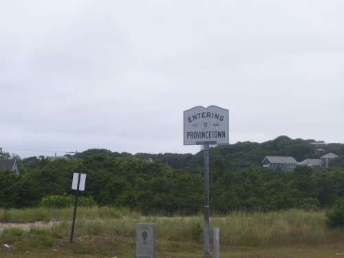
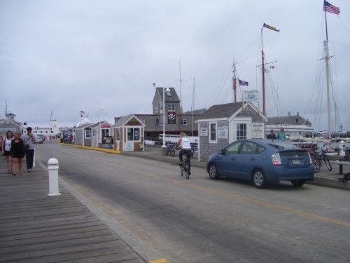
Cape Cod is an “end of the road” kind of place. Literally and figuratively. P-town is the “end of the road”, at the end of the road. It is sort of like going out to the very edge of the world. When I first moved out East I would have bouts of claustrophobia from all the hills and trees (I grew up in the very flat of the Midwest don’t judge) and I would go out and stare at the ocean to make myself feel better. People are more accepting of difference as you get out to the end of the world. Perhaps this is why P-town has attracted so many gay and lesbian people. When you live at the end of the road you are more open to greeting anyone who might wander by as a friend. I felt like P-town was welcoming me after my long bike ride.
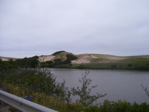
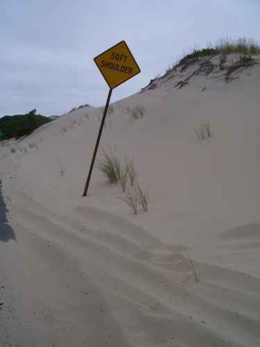
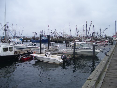
As you head to the end of the world the climate starts to change. The trees thin out and start to get shorter. The weather here is too rough on them to allow them to get very tall. Sand dune start to pop up, and the ocean starts to encircle you. After a while…there is no more road. You are at the end, this is it, from here on out thar be dragons. It is a great feeling, a scary feeling and after all that biking, a welcoming chance to stop. I once thought that mercy was the ability to stop, now I felt it first hand. I sat down and took stock of myself. All limbs attached and in mostly working order (my knees were sore, but feel much better today), my shoulders stopped hurting and my hands regained feeling in about 30 minutes, and then the hunger started. I was really really hungry. I got some onion rings, and some cheese pizza. It tasted like cardboard, but taste wasn’t what I wanted; grease, fat, oil, calories, these are what I wanted. The food disappeared in short order and then I drank some water. I sat peacefully for a while till the fast ferry came.
I felt kind of bad for the people next to me on the boat as I stunk to high hell. You know when you can smell yourself kind of stink? Yea that bad. I guess I didn’t care that much because I promptly passed out, when I awoke Boston, home sweet home was there to greet me. It was a nice little bike ride.
Some stats:
Living things I saw:
Trees
Birds
Horseys
Sheepys
Goatys
Chikin’s
People
Dead things I saw:
mice (2)
snake
deer (almost ran it over…yuk)
fisher cat
squirrel (3)
birds (2)
unidentified pile of bones and gross (3)
Places I pee’d:
CVS
Half constructed home (thanks guys for leaving the portajohn unlocked!)
My old office
Public Bathroom in P-town
Food I ate:
Mini Cliff Bars (6)
King Size M&M’s (1)
Snickers (2)
Chunky crunch bar (1)
Onion Rings (plate)
Cheese Pizza (1 slice)
Taza Chocolate bar (1)
Banana (1)
Things I drank (my water bottle is one of them big metal ones):
Water bottles full of water (3)
Water bottle full of Gatorade (3)
Orange juice (1 small bottle from store)
Distance:
168 miles
Time:
11 hours (6:30am to 5:30pm)
Average speed:
~15 mph (woot!)
Calories Burned:
~5400 (according to various internet websites could be wrong)
Gear:
Bailyworks messenger bag (large)
Vans (1 pair)
fixed gear bike (46×16 gearing)
Sylvan pedals with toe cages
Pearl Izumi Bike shorts (first time I had ever ridden with bike shorts with a Chamois in them)
Paceline Chamois Butt’r (was a little reluctant to use this, but turned out to be a very good idea)
Bike pump
Tubes (3)
tire levers
adjustable wrench
maps
journal
camera
bike hat
bike gloves
pair of jean shorts (worn at the end to stay warm)
wallet
cell phone
keys
mini u-lock
water bottle
small amount of toilet paper (just in case not used)
Tags: awesome, boston, cape cod, dennis, ferry, fixed gear, long bike ride, Provincetown, turo, wellfleet
Posted in bostonbiker, fun, routes | 19 Comments »
BU Bridge To Be Shut Down For A Bit
Written by Boston Biker on Jan 08This just in from BUBikes
This just in from the Department of Conservation and Recreation:
On Jan 8-9, Thursday night to Friday morning, 10 pm to 5 am, Department of Conservation and Recreation (DCR) crews will be making repairs to the BU Bridge sidewalks. During the work, both Cambridge-to-Boston lanes will be closed, and the only traffic allowed to cross in that direction will be Boston-bound MBTA or Boston University buses. All other traffic from Cambridge to Boston will be detoured to the Massachusetts Avenue Bridge.
So, if you plan to ride the BU Bridge, be aware.
that’s all – we’ll keep you updated on anything else that comes our way.
Yes thats right, you just witnessed the rare double “this just in.” Something to tell the grandkids about.
Tags: BU Bridge, BUBikes, Construction
Posted in news, routes | 1 Comment »
The City Of Boston Has Been Busy Making Maps
Written by Boston Biker on Aug 18Found these little gems on Google Maps, seems the city might be up to something….
I will keep on top of this.
Bike Shops
Green – Key Shops Purple – First Tier Shops Blue – Second Tier Shops Aqua – Visited Red – No longer at this address
No idea what the tier system means, but this is a pretty good map of local shops. Might add it to the bike map page.
Lanes
I am pretty sure that green lines mean proposed lanes, and blue are existing. If every street that is green ends up getting a lane that would be fantastic, but still just the start of a vibrant bicycle infrastructure project. I hope those greens turn blue soon!
Racks
Blue = Requested
Green = In Process
Orange = Installed
Purple = Dead
Yellow = Hold
Pretty sure this has to do with the recent push from the city to install a whole bunch of new racks. My sources tell me that they will be installing over 250.
Speaking of maps, be sure to check out the ever growing BostonBiker.org bike map, be sure to add your own favorite locations!
Tags: Bike Lanes, bike maps, bike racks, bike shops., boston
Posted in advocacy, news, routes | Comments Off on The City Of Boston Has Been Busy Making Maps
The Path Less Traveled
Written by Boston Biker on May 27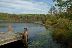 Mark Laurence posted this great story of his ride down the Stony Brook Reservation bike paths. It reads like poetry. Thanks for letting me share it with everyone Mark.
Yesterday I did something I’ve been putting off for years: I took a
ride through Stony Brook Reservation in West Roxbury and Hyde Park, on
its network of bike trails. I was curious about how they’d compare to
other bike paths in the area, and what it was like being in this city
version of the woods. Have any of you ever been there? I don’t think
I’ve ever read anything online from someone who has, except for some
pictures taken about a year ago by Doug Mink.I start out by riding on Enneking Parkway past Turtle Pond. Lots of
fast cars. Some “cautious” crazy person passes me with 10 feet to
spare, cruising into a blind curve on the wrong side of the street.
Someday I’m sure I’ll see a head-on collision when somebody pulls this
stunt.My first trail starts here with a fairly steep climb. The path was
asphalt and winding, more for a mountain bike. It’s not long before
you’re surrounded by woods. The trail is maintained in most parts,
but completely destroyed in several places by spring runoff water.
I’ve never seen asphalt buckled like this, and I’m forced to walk for
a while.At the southwest corner of the Reservation, it looks like a left turn
onto “Gavin Path” but this is not a bike path by any stretch of the
imagination. I walk down the trail, past broken fences and piles of
trash. Before long I can ride, about 3/4 mile crossing Dedham Parkway
and Turtle Pond Parkway onto Chamberlain Path. But after these paths,
Melnea Cass bikepath will seem like an Interstate.This part of the ride has a strange feel to it. At times you are next
to peoples’ backyards, and you constantly hear sounds of people,
playing in a sports field or driving on the main roads which are never
far away. But in your own vision it’s the wilderness, there’s nobody
in sight, and the path seems like something out of the northern Maine
woods.Chamberlain Path ends near Dedham Parkway, and after a short turn
north there’s an entrance to Stony Brook Path. This looks more park-
like than anything I’ve seen, with a bulletin board for park rules and
activities. Stony Brook Path is in much better shape than the others,
and is more used – I see a few joggers and hikers, but no other
bikes. Interesting – it’s farther away from civilization, but the
path feels closer to the city because there’s more evidence of use.
About halfway up you get the nicest view, overlooking Turtle Pond from
the side few people see. This is worth coming back to.So I do, making a circle on a path that goes downhill along the
Reservation’s eastern border, next to the George Wright Golf Course.
You do see the putting greens and the golf course flags on the left.
Otherwise, this is the least interesting part of the trip, and I’m
glad when I reach the gate with the bulletin board and retrace my
route past Turtle Pond.This time I keep going on what becomes East Boundary Path on my way
out of the reservation. It looks like it was built on a railroad bed,
with a straight flat grade through marshland and woods. It also looks
like it’s beloved by weekend metal-heads, with names of rock bands
painted on the road. It makes me worry about broken glass, but
someone has kept these trails pretty clean.At the end of the trail, I’m amazed to see what looks like a gated
community. I didn’t think there was such a thing in West Roxbury, but
here is a security guard and separate gates for residents and
visitors. I’m back to civilization, but in these woods it’s never
very far away at all.
Tags: bike ride, poetry, stony brook reservation
Posted in fun, routes | 1 Comment »
Playing With Bike Routes
Written by Boston Biker on Jan 18So I was thinking of sharing some of my bike routes that I take, and maybe the rest of you can share some as well. I have been playing around with MapMyRide.com.
Signing up is free, and only takes a couple second, and if you want you can even put in information about your height/weight etc and it will calculate calories and all sorts of other stuff for you (this ride apparently burns about 300 calories, meaning I am burning about 600 a day as I do it twice a day). Once you have the route all mapped out they have a fun “export to blog” feature (which you see above) they give you a little snippet of code that you paste into a post and whalla, you have a route for people to see.
You can even get real detailed and mark it up with notes, water stops, and all sorts of other fun stuff. If anyone tries it drop me a note in the comments with a link to your post with a map on it.
Tags: bike rides, commute
Posted in bostonbiker, routes | Comments Off on Playing With Bike Routes
The Word On The Street
 Here is what people are saying
- Where bicycles are prohibited in Massachusetts August 16, 2023TweetThe main issue you will confront if you get into a dispute with police over bicycle prohibitions is whether the prohibition is supported by law. Often it is not. Example: the ramp from Commonwealth Avenue to Route 128 northbound and … Continue reading →jsallen
- Where bicycles are prohibited in Massachusetts August 16, 2023TweetThe main issue you will confront if you get into a dispute with police over bicycle prohibitions is whether the prohibition is supported by law. Often it is not. Example: the ramp from Commonwealth Avenue to Route 128 northbound and … Continue reading →jsallen
- It’s Finally Happening! 5th Annual Hot Cocoa Ride Feb 12! February 8, 2022... Continue reading →commonwheels
- It’s Finally Happening! 5th Annual Hot Cocoa Ride Feb 12! February 8, 2022... Continue reading →commonwheels
- Hello world! June 9, 2021Welcome to WordPress. This is your first post. Edit or delete it, then start writing! Continue reading →thecommunityspoke
- Run The Jewels Lead Free Pewter Hand Carved And Cast Pin Set January 3, 2021Made these lovely RTJ fist and gun pin set. Hand carved in wax, and then cast in lead free pewter. Because these are made by hand you can do fun things like add an extra small pin so that they sit just so (also means they have “customized” brass back plates to accommodate the extra […]Boston Biker
- My Work In The Wild: Feather Head Badge With Chris King Headset January 3, 2021One of my customers sent me this amazing picture of my feather badge installed on their (awesome!) bike. Check out Manofmultnomah (here and here), apparently Chris King took some interest in it as well. Want one of your own? Buy it here, or here... Continue reading →Boston Biker
- Boston’s Invitation to Improve Biking in Boston: Draw on Some Maps! December 14, 2020TweetSometimes, the best way to gather ideas and feedback is to let people draw on some maps. Last night, at the Bike Network Open House, pedallovers unveiled a draft for their upcoming plans for a more connected biking network infrastructure … Continue reading →greg
- Boston’s Invitation to Improve Biking in Boston: Draw on Some Maps! December 14, 2020TweetSometimes, the best way to gather ideas and feedback is to let people draw on some maps. Last night, at the Bike Network Open House, pedallovers unveiled a draft for their upcoming plans for a more connected biking network infrastructure … Continue reading →greg
- Boston’s Invitation to Improve Biking in Boston: Draw on Some Maps! December 14, 2020TweetSometimes, the best way to gather ideas and feedback is to let people draw on some maps. Last night, at the Bike Network Open House, pedallovers unveiled a draft for their upcoming plans for a more connected biking network infrastructure … Continue reading →greg
 Add to Reddit.

