The Latest From BostonBiker.org
News, Events, Updates
One If By Land, Two (Wheels) If By Sea
Written by Boston Biker on Aug 12Seems that Winthrop now has a boat that will take you from East Boston to Downtown. Got this in the email.
I have to share my exciting commute. For years I’ve been trying to find a land route from East Boston to downtown that doesn’t go over the cavernous craters of Chelsea or travel with the hell-fired cars that speed down Route 99. Up to now, I’ve relegated myself to locking up my bike at Orient Heights and taking the T downtown. This is all because the T doesn’t allow bicycles on board during standard commuting hours.
As of last week, I now have a land sea route! Winthrop now has a ferry! And I just have to say it’s been awesome. They welcome bikes and I can grab a beer on the ride home if I want. I met the project manager for Boston Harbor Cruises. He may consider getting some bike hooks or stands for the bikes to use while en-route. Check out the schedule: here
While this seams like a pricey option if you were going to do it daily, for the occasional jaunt out that way its not bad.
Thanks Marcie for the heads up.
 If By Sea to reddit.com") Add to Reddit.
Add to Reddit. Posted in news, routes | 5 Comments »
Google Adds “By Bike” To Google Maps
Written by Boston Biker on Mar 10Swwwwweeeeeet!
Whenever I meet someone who finds out that I work on the directions team for Google Maps, the first question I’m asked is often “So when’s Google Maps going to add biking directions?” We’re big biking fans too, so we’ve been itching to give you a concrete answer. I don’t want to keep the good news a secret any longer, so the answer is: right now!
Today we’ve added biking directions and extensive bike trail data to Google Maps for the U.S. My team has been keeping close tabs on all the public support for biking directions that’s been steadily coming in, but we knew that when we added the feature, we wanted to do it right: we wanted to include as much bike trail data as possible, provide efficient routes, allow riders to customize their trip, make use of bike lanes, calculate rider-friendly routes that avoid big hills and customize the look of the map for cycling to encourage folks to hop on their bikes. So that’s exactly what we’ve done.
Let’s say you want to bike to work, or maybe you want to drive less and spend more time outdoors. Biking directions can help you find a convenient and efficient route that makes use of dedicated bike trails or lanes and avoids hills whenever possible. To find biking directions, select “Bicycling” from the drop-down menu when you do a directions search:

Read more here

* Dark green indicates a dedicated bike-only trail;
* Light green indicates a dedicated bike lane along a road;
* Dashed green indicates roads that are designated as preferred for bicycling, but without dedicated lanes
This is actually pretty awesome, and you can help it get better by using the report a problem link (bottom right of the map), basically this is what Boston has needed for a long time, a dynamic, user editable bike map of the city that can be collaborated on by thousands of bikers at all hours of the day and night.
Just to be silly I wanted to see what this could do so I typed in Boston to Ohio and low and behold in a mere 3 days and 11 hours google say I could be enjoying the midwest…As this grows it could be a boon to bike riders the world over.
Add to Reddit. Posted in fun, routes | 15 Comments »
Give Matt A Hand
Written by Boston Biker on Nov 06Anyone know any info that could help this guy out?
——
hi, I am a longtime area resident but new to biking.
I ride in from the south with MIT as my destination. This morning I came in on the Washington St. bike lane to the Pierre Lallement trail and then to Columbus Street. I turned left on Mass Ave and crossed the bridge. All was wonderful except for Mass Ave, which was somewhat terrifying for a first-timer like me.
On the way home I instead crossed the Longfellow Park bridge, and then took Charles St. to Dartmouth and then back to the Columbus Street bike lane. Neither Charles nor Dartmouth was as scary as Mass Ave but still not great.
I’m wondering, are there other/better ways to get from Columbus to the bridges? Alternatively, I could come up the Jamaicaway bike path and try to get to the B.U. bridge (once it reopens) though I don’t know the best connection to do that.
Thanks for any advice!
Matt
Leave your tips in the comments.
Add to Reddit. Posted in Questions, routes | 7 Comments »
North Shore To Boston: Impossible Journey
Written by Boston Biker on Nov 02The Impossible Journey from John Bonner on Vimeo.
This amazing journey was completed by one brave soul John Bonner, with tongue firmly in cheek he takes us on this epic quest to bicycle into Boston from the north. I have often been amazed at how fun some of the places north and east of Boston can be to ride around in, and horrified at how hard it is to get there by bike. Lets hope that the new bike friendly city includes ways to get into and out of it. You can find a lot more info about this fantastic voyage here.
Add to Reddit. Posted in fun, routes, video | 7 Comments »
Bruce Freeman Rail Trail, You CAN Get There From Here
Written by Boston Biker on Sep 11So many of you heard, the Bruce Freeman Rail Trail in Chelmsford is now open, after many (many) years of struggle the first link in what will one day be a very impressive trail is up and running!
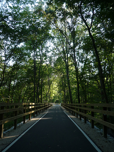
The problem of course is if you live in Boston, how do you get out to ride this badboy? Lucky for us Maria Varmazis has done all the leg work for us! Not only has she written up a fantastic tour of the entire trail, but has helpfully included a map for how to get from the end of the Minute Man Trail to the start of the BFRT! Thanks Maria!
Add to Reddit. Posted in routes | 3 Comments »
The Word On The Street
 Here is what people are saying
- Where bicycles are prohibited in Massachusetts August 16, 2023TweetThe main issue you will confront if you get into a dispute with police over bicycle prohibitions is whether the prohibition is supported by law. Often it is not. Example: the ramp from Commonwealth Avenue to Route 128 northbound and … Continue reading →jsallen
- Where bicycles are prohibited in Massachusetts August 16, 2023TweetThe main issue you will confront if you get into a dispute with police over bicycle prohibitions is whether the prohibition is supported by law. Often it is not. Example: the ramp from Commonwealth Avenue to Route 128 northbound and … Continue reading →jsallen
- It’s Finally Happening! 5th Annual Hot Cocoa Ride Feb 12! February 8, 2022... Continue reading →commonwheels
- It’s Finally Happening! 5th Annual Hot Cocoa Ride Feb 12! February 8, 2022... Continue reading →commonwheels
- Hello world! June 9, 2021Welcome to WordPress. This is your first post. Edit or delete it, then start writing! Continue reading →thecommunityspoke
- Run The Jewels Lead Free Pewter Hand Carved And Cast Pin Set January 3, 2021Made these lovely RTJ fist and gun pin set. Hand carved in wax, and then cast in lead free pewter. Because these are made by hand you can do fun things like add an extra small pin so that they sit just so (also means they have “customized” brass back plates to accommodate the extra […]Boston Biker
- My Work In The Wild: Feather Head Badge With Chris King Headset January 3, 2021One of my customers sent me this amazing picture of my feather badge installed on their (awesome!) bike. Check out Manofmultnomah (here and here), apparently Chris King took some interest in it as well. Want one of your own? Buy it here, or here... Continue reading →Boston Biker
- Boston’s Invitation to Improve Biking in Boston: Draw on Some Maps! December 14, 2020TweetSometimes, the best way to gather ideas and feedback is to let people draw on some maps. Last night, at the Bike Network Open House, pedallovers unveiled a draft for their upcoming plans for a more connected biking network infrastructure … Continue reading →greg
- Boston’s Invitation to Improve Biking in Boston: Draw on Some Maps! December 14, 2020TweetSometimes, the best way to gather ideas and feedback is to let people draw on some maps. Last night, at the Bike Network Open House, pedallovers unveiled a draft for their upcoming plans for a more connected biking network infrastructure … Continue reading →greg
- Boston’s Invitation to Improve Biking in Boston: Draw on Some Maps! December 14, 2020TweetSometimes, the best way to gather ideas and feedback is to let people draw on some maps. Last night, at the Bike Network Open House, pedallovers unveiled a draft for their upcoming plans for a more connected biking network infrastructure … Continue reading →greg