The Latest From BostonBiker.org
News, Events, Updates
Smart Kids At Northeastern Making The City Better For Cyclists
Written by Boston Biker on Apr 21I went to this last year, it was fascinating and filled me with hope that it is not only possible to build a great bike infrastructure but that there are smart people out there doing the planning for it.
—–
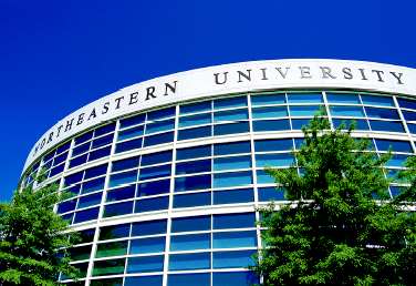
Friends of Northeastern University’s Transportation Engineering program:
You are invited to the final presentations of the Class of 2009 senior design projects in transportation engineering, to be held Wednesday April 22, 6:30 pm, in 108 Snell Engineering Center. The students will present designs for four outstanding bikeways:
– a cycle track (separated bike path) along Boylston Street from Fenway to the Public Garden, and all the way around the Public Garden
– a cycle track parallel to the Harbor Commercial Street in the North End to Kneeland Street in Chinatown
– a cycle track from Melnea Cass Blvd. to UMass, via Southampton, Preble, Old Colony, and Morrissey Blvd (right past the Globe)
– a greenway along Lee / Clyde Streets in Brookline for walking and bicycling
Each design demonstrates the feasibility of “road diets” that make it possible to make roadways narrower, providing the space needed for traffic-separated bike paths — exactly what Boston most needs to promote bicycling and bicycle safety.
Please see the attachedflyer.
(pdf)
Peter Furth and Dan Dulaski
Faculty advisers
 Add to Reddit.
 Posted in advocacy | 1 Comment »
Boston Greenways: Eight Missing Links
Written by Boston Biker on Apr 08
You are cordially invited to the final presentations for the senior design projects (capstone projects) in transportation engineering, Tuesday April 22, 6:30 pm, in 108 Snell Engineering Center. The presentations, entitled “Boston Greenways: Eight Missing Links” are co-sponsored by the Emerald Necklace Conservancy, MassBike, WalkBoston, the Fenway Alliance, and the Solomon Fund, as well as the projects’ client, the City of Boston.
In case you missed it, the students’ work was featured in last Sunday’s Globe
The final presentation is open to the public, so please feel free to invite interested people. It will consist of a plenary session lasting about 1.5 hours in which the projects are all presented, and will be followed by a time for participants to view the designs in more detail and discuss them with students teams, who will be stationed around the lobby of the Snell Engineering Center.
PROJECT LIST
1. Charlesgate path: multiuse path along and under the Bowker overpass connecting the Back Bay Fens with both the Charles River bike path and the Mass Ave bridge.
2. Arborway: new traffic circulation scheme for Arborway between Jamaica Pond (Kelly Circle) and the Arboretum (Murray Circle), with the goal of concentrating through traffic in the inner roadway and restoring the park / path function of the medians between the inner and outer roadways, allowing the Emerald Necklace paths to extend from Jamaica Pond to the Arboretum.
3. Route 9 Crossing for Muddy River path: building on last year’s project, a more detailed design
of improvements to bring the Muddy River path across Route 9 and across Brookline Ave to Netherlands Road. Includes bridge alternatives, embankment modifications, and traffic circulation changes with associated traffic signal studies.
4. World Series path: multiuse path between Ruggles Station and Fenway, including a modified Huntington Ave crossing. This path has same function, but a different alignment, as the Linking the Corridors Path.
5. Bike lanes on Commonwealth Ave. from the Public Garden to Kenmore Square.
6. Bike lanes on Commonwealth Ave. from the BU Bridge to Warren Street via Packard’s Corner.
7. Bike lanes on Dartmouth Street (Back Bay)
8. Bike lanes on Summer Street / L Street from the Fort Point Channel to the L Street Beach in South Boston
Add to Reddit. Posted in advocacy, news | 1 Comment »
The Word On The Street
 Here is what people are saying
- Where bicycles are prohibited in Massachusetts August 16, 2023TweetThe main issue you will confront if you get into a dispute with police over bicycle prohibitions is whether the prohibition is supported by law. Often it is not. Example: the ramp from Commonwealth Avenue to Route 128 northbound and … Continue reading →jsallen
- Where bicycles are prohibited in Massachusetts August 16, 2023TweetThe main issue you will confront if you get into a dispute with police over bicycle prohibitions is whether the prohibition is supported by law. Often it is not. Example: the ramp from Commonwealth Avenue to Route 128 northbound and … Continue reading →jsallen
- It’s Finally Happening! 5th Annual Hot Cocoa Ride Feb 12! February 8, 2022... Continue reading →commonwheels
- It’s Finally Happening! 5th Annual Hot Cocoa Ride Feb 12! February 8, 2022... Continue reading →commonwheels
- Hello world! June 9, 2021Welcome to WordPress. This is your first post. Edit or delete it, then start writing! Continue reading →thecommunityspoke
- Run The Jewels Lead Free Pewter Hand Carved And Cast Pin Set January 3, 2021Made these lovely RTJ fist and gun pin set. Hand carved in wax, and then cast in lead free pewter. Because these are made by hand you can do fun things like add an extra small pin so that they sit just so (also means they have “customized” brass back plates to accommodate the extra […]Boston Biker
- My Work In The Wild: Feather Head Badge With Chris King Headset January 3, 2021One of my customers sent me this amazing picture of my feather badge installed on their (awesome!) bike. Check out Manofmultnomah (here and here), apparently Chris King took some interest in it as well. Want one of your own? Buy it here, or here... Continue reading →Boston Biker
- Boston’s Invitation to Improve Biking in Boston: Draw on Some Maps! December 14, 2020TweetSometimes, the best way to gather ideas and feedback is to let people draw on some maps. Last night, at the Bike Network Open House, pedallovers unveiled a draft for their upcoming plans for a more connected biking network infrastructure … Continue reading →greg
- Boston’s Invitation to Improve Biking in Boston: Draw on Some Maps! December 14, 2020TweetSometimes, the best way to gather ideas and feedback is to let people draw on some maps. Last night, at the Bike Network Open House, pedallovers unveiled a draft for their upcoming plans for a more connected biking network infrastructure … Continue reading →greg
- Boston’s Invitation to Improve Biking in Boston: Draw on Some Maps! December 14, 2020TweetSometimes, the best way to gather ideas and feedback is to let people draw on some maps. Last night, at the Bike Network Open House, pedallovers unveiled a draft for their upcoming plans for a more connected biking network infrastructure … Continue reading →greg